Inspect where the maps and numbers came from, what they describe and what will need another check when conditions change.
Started 16 October · Updated Facts carry their own source and periodWhat changed & when
Page and rule register · updated 3 November 2026
What was built, and when?
Nineteen new pages were verified on 17 October 2026. The original journey began on 16 October; the division pages were added on 17 October. Page updates and source research dates are recorded separately.
The local journey · 8 pages
Work started 2026-10-16 · first verified build 2026-10-17.
A page update is not a new Census observation, map edition or election notice. The source records keep those dates. Review before publishing and when the listed conditions change.
Mayoral vacancy and election process: 28 October 2026
Council confirms the vacancy and acting arrangement. ECQ supplies the event timetable; legislation explains the process. A scheduling interval is not a confirmed polling date.
A 2026 research check does not turn 2021 Census figures into 2026 Census results. Population estimates and census counts are different measures; the geography and reference date must travel with each number.
Reviewed local indicators
Indicator
Figure
Period and geography
Definition, limit and source
Estimated residents
172,831 people
30 June 2025 Redland LGA (ABS code 36250)
Preliminary estimate. ERP is not a Census count. Original source · Checked 2026-10-16
Previous year's revised ERP
169,940 people
30 June 2024 Redland LGA (ABS code 36250)
Use this revised value for comparison with the 2025 release. Original source · Checked 2026-10-16
These are local raster copies of actual source maps. They are not georeferenced overlays, parcel advice or a statistical intersection calculation. Different editions and scales cannot establish a percentage overlap by visual comparison.
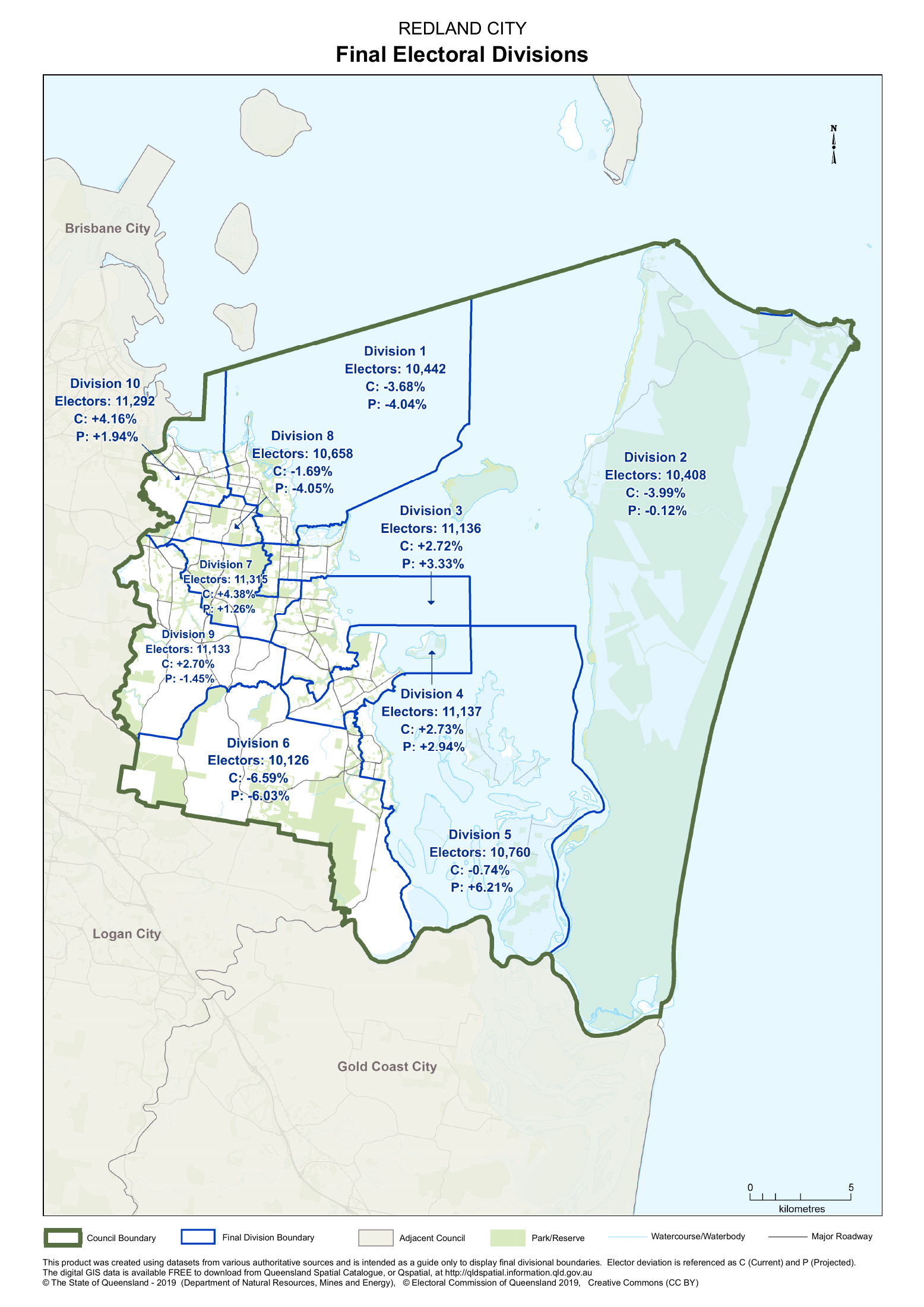
Redland City council, its ten electoral divisions, state districts and federal divisions are different geographies.
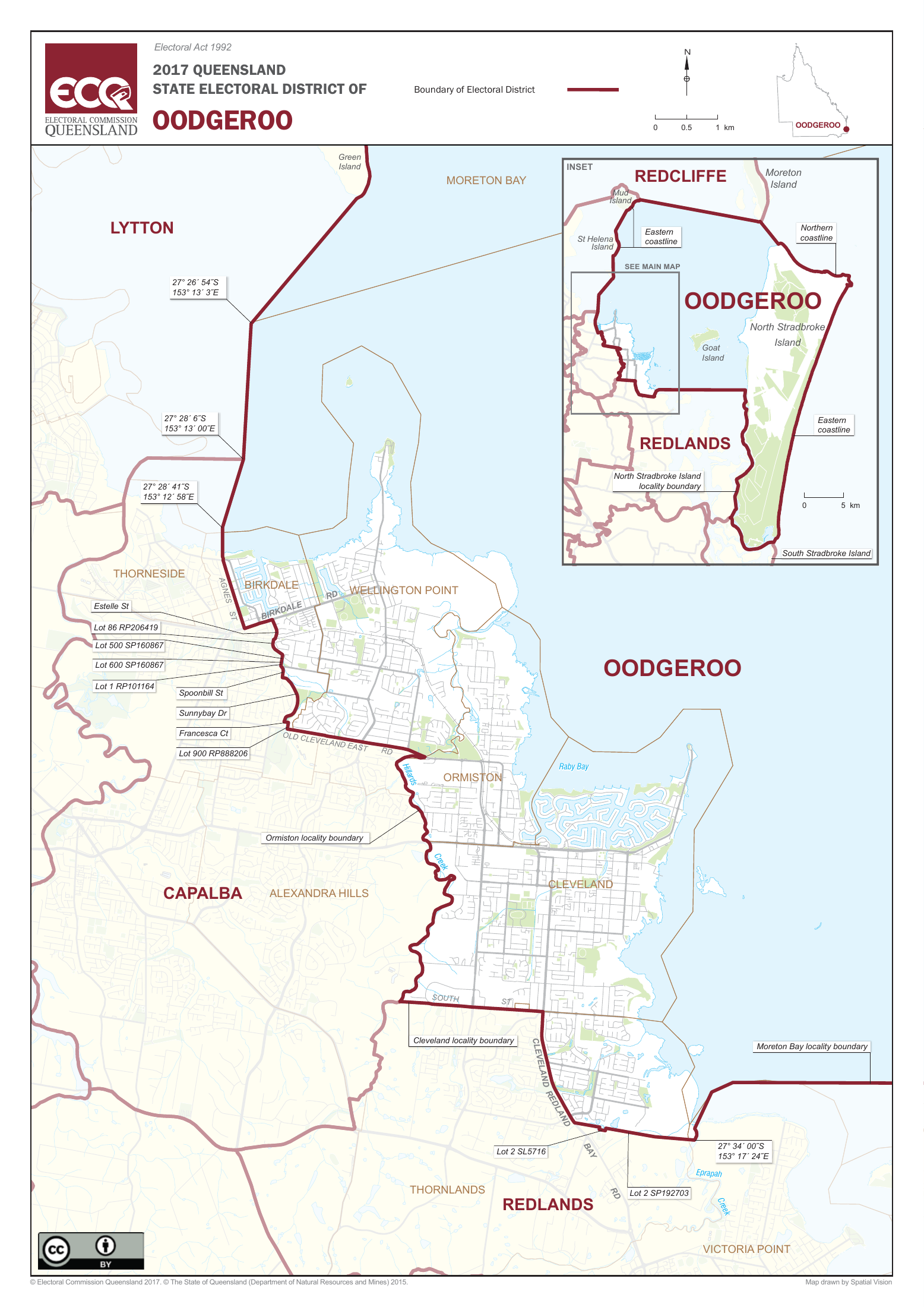
The 2017 state boundaries remain in use for current representation and any by-election until the October 2028 state general election; new boundaries were set in June 2026.
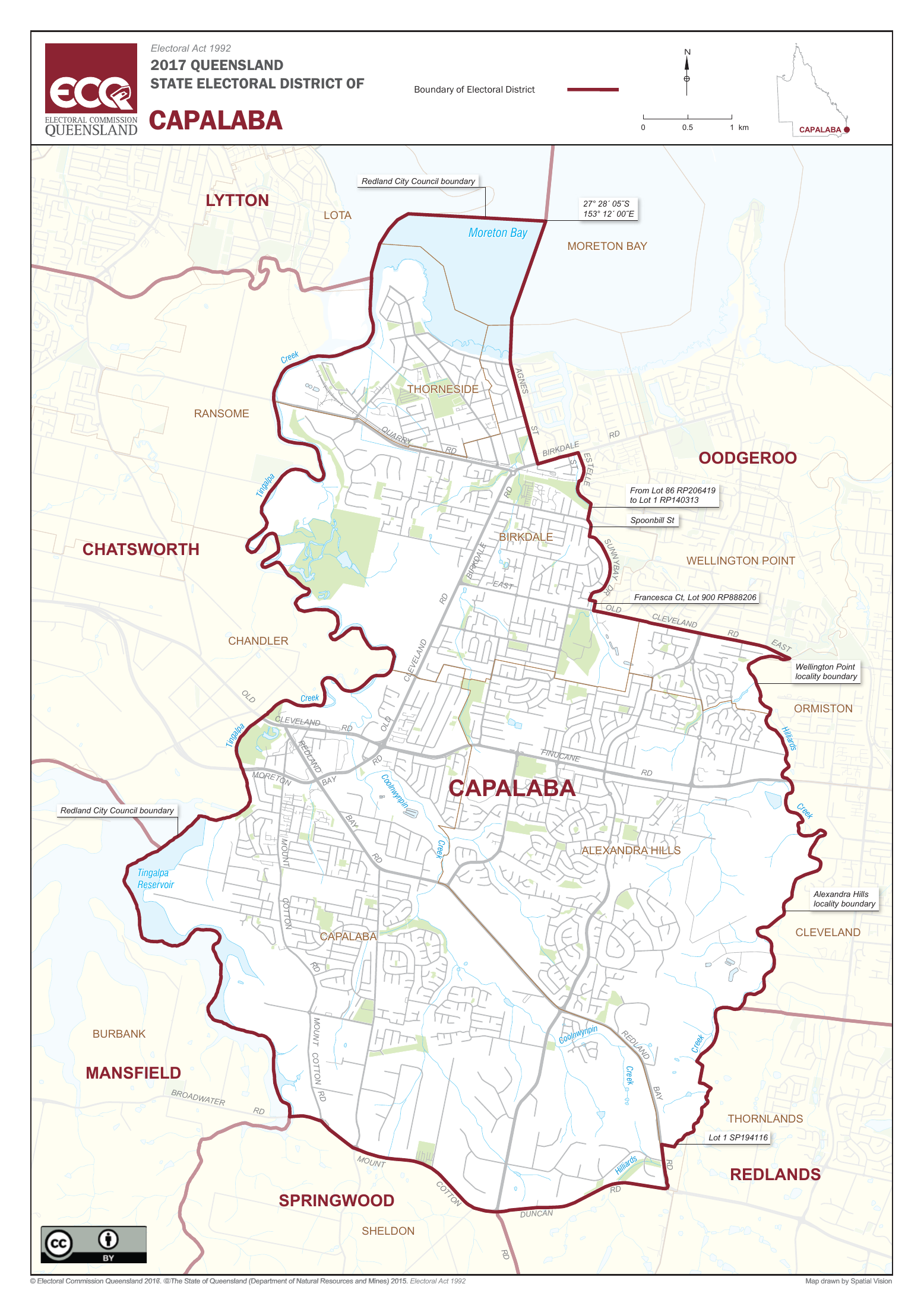
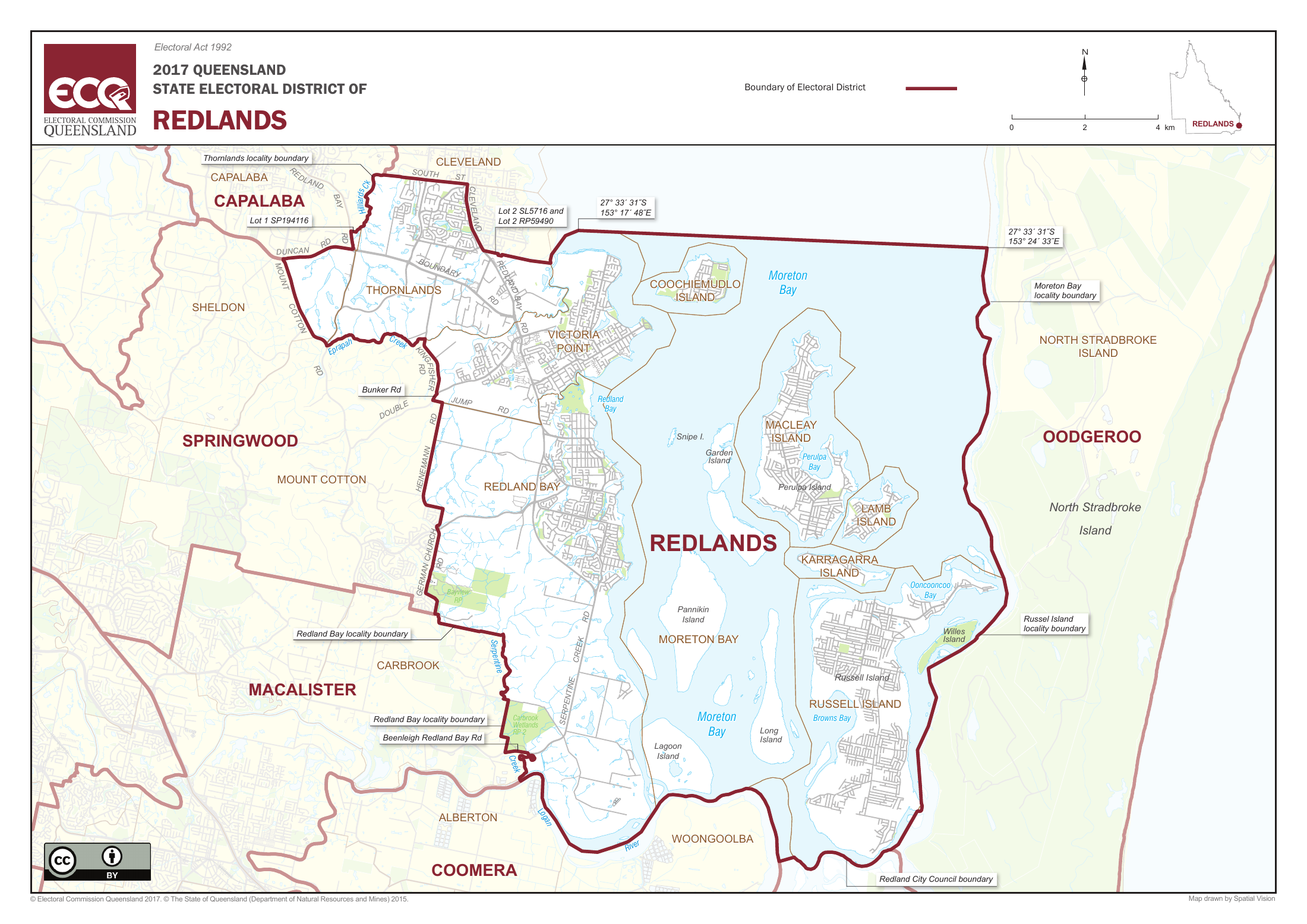
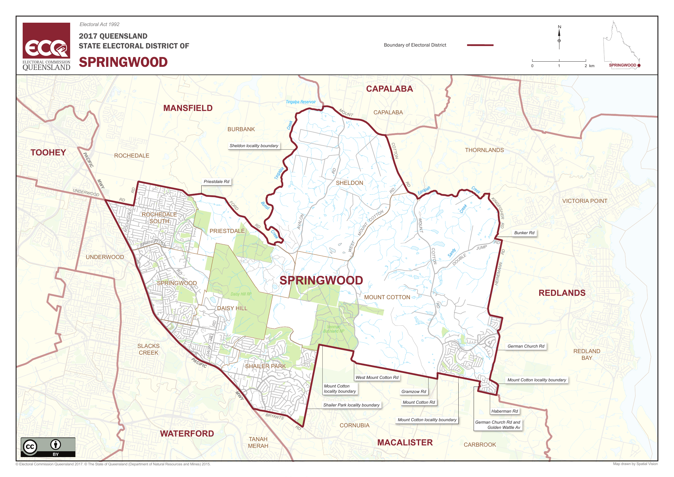
Current state districts relevant to the council include Capalaba, Oodgeroo, Redlands and Springwood. Exact addresses must be checked with ECQ.
No calculated area, resident or elector overlap percentage is asserted. Coastal water boundaries, land area, ABS mesh-block approximations and different editions can produce different totals.
Electoral boundaries do not define or settle Country, Traditional Owner rights or cultural authority.
Redland City: official final electoral divisions The State of Queensland - 2019 (Department of Natural Resources, Mines and Energy); Electoral Commission of Queensland 2019. Creative Commons (CC BY). · 2019 final determination, published 20 September 2019, for the 2020 election Original map and boundary source · Open full-size image · Retained original PDF · Reuse conditions Shows the final ten divisions and outer council boundary from the 2019 review. Printed elector counts and current/projected quota deviations belong to that historical review, not 2026 enrolment. The source describes the map as a guide; use ECQ's current address finder for an exact address.
Retrieved/checked: 2026-10-17. Rights: Creative Commons Attribution (CC BY), as printed on the source map. The version is not specified on this page; source-specific rights are retained.
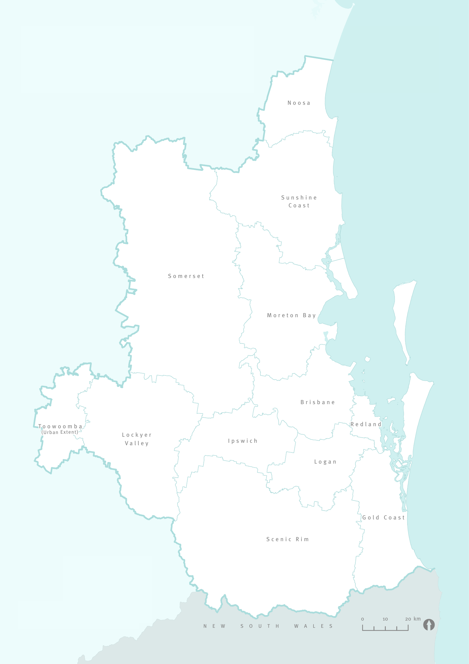
South East Queensland councils: ShapingSEQ 2023 Queensland Government, ShapingSEQ 2023 Map 3; source PDF mirrored on Wikimedia Commons by NimbleNumbat. · ShapingSEQ 2023, Map 3; Commons upload November 2025 Original map and boundary source · Open full-size image · Retained original PDF · Reuse conditions South East Queensland regional-plan context, not all 77 Queensland councils. Toowoomba is labelled urban extent. Does not show council electoral divisions or a precise address lookup.
Retrieved/checked: 2026-10-17. Rights: Creative Commons Attribution 4.0, as recorded on the Commons description page; original publication copyright and mapping disclaimer apply.
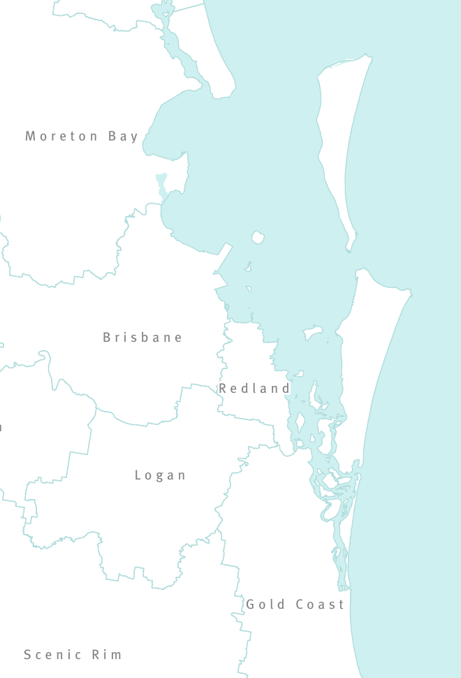
Redland and neighbours: detail from the 2023 regional-plan map Queensland Government, ShapingSEQ 2023 Map 3; source PDF mirrored on Wikimedia Commons by NimbleNumbat. · ShapingSEQ 2023, Map 3; Commons upload November 2025 Original map and boundary source · Open full-size image · Retained original PDF · Reuse conditions Regional context only. Some neighbouring labels are outside this crop; the full source map is supplied. Does not depict precise coastal water jurisdictions or the ten council divisions.
Retrieved/checked: 2026-10-17. Rights: Creative Commons Attribution 4.0, as recorded on the Commons description page; original publication copyright and mapping disclaimer apply.
Oodgeroo: current representation boundary Electoral Commission Queensland 2017; State of Queensland (Department of Natural Resources and Mines) 2015; map drawn by Spatial Vision. Source PDF mirrored by Wikimedia Commons. · 2017 electoral boundaries Original map and boundary source · Open full-size image · Retained original PDF · Wikimedia source record · Reuse conditions Current parliamentary representation and any state by-election use the 2017 boundaries. The June 2026 redistribution applies at the next state general election in October 2028. Printed roads and background are historical.
Capalaba: current representation boundary Electoral Commission Queensland 2017; State of Queensland (Department of Natural Resources and Mines) 2015; map drawn by Spatial Vision. Source PDF mirrored by Wikimedia Commons. · 2017 electoral boundaries Original map and boundary source · Open full-size image · Retained original PDF · Wikimedia source record · Reuse conditions Current parliamentary representation and any state by-election use the 2017 boundaries. The June 2026 redistribution applies at the next state general election in October 2028. Printed roads and background are historical.
Redlands state district: current representation boundary Electoral Commission Queensland 2017; State of Queensland (Department of Natural Resources and Mines) 2015; map drawn by Spatial Vision. Source PDF mirrored by Wikimedia Commons. · 2017 electoral boundaries Original map and boundary source · Open full-size image · Retained original PDF · Wikimedia source record · Reuse conditions Current parliamentary representation and any state by-election use the 2017 boundaries. The June 2026 redistribution applies at the next state general election in October 2028. Printed roads and background are historical.
Springwood: current representation boundary Electoral Commission Queensland 2017; State of Queensland (Department of Natural Resources and Mines) 2015; map drawn by Spatial Vision. Source PDF mirrored by Wikimedia Commons. · 2017 electoral boundaries Original map and boundary source · Open full-size image · Retained original PDF · Wikimedia source record · Reuse conditions Current parliamentary representation and any state by-election use the 2017 boundaries. The June 2026 redistribution applies at the next state general election in October 2028. Printed roads and background are historical.
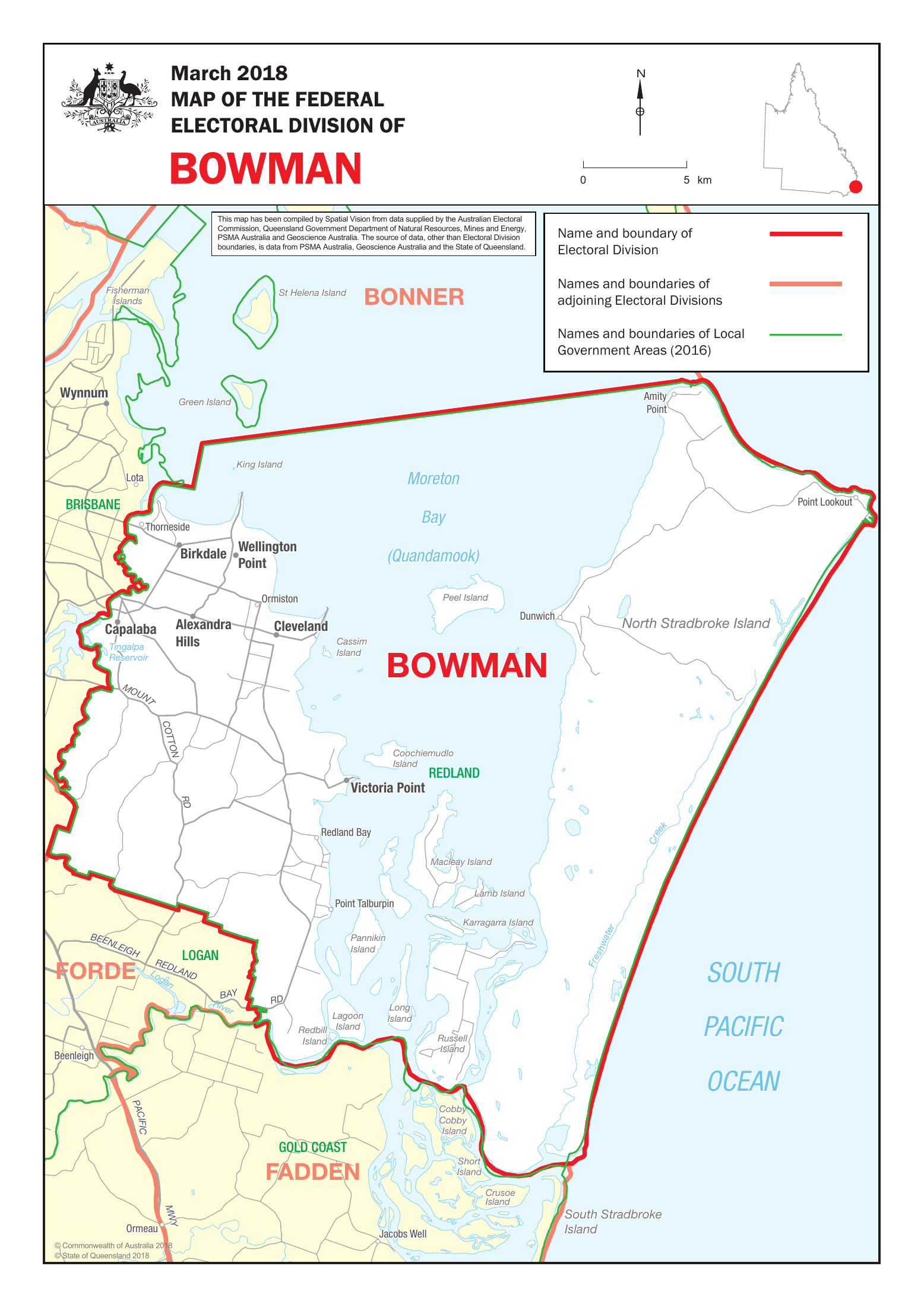
Bowman federal electoral division Commonwealth of Australia 2018; State of Queensland 2018. Compiled by Spatial Vision for the Australian Electoral Commission, with credited source data retained on the map. · March 2018; first used at the 2019 federal election Original map and boundary source · Open full-size image · Retained original PDF · Reuse conditions AEC profile describes Bowman as parts of Redland and Brisbane councils. The map's council reference layer is 2016. Do not assert exact council equivalence or infer overlap percentages from this image.
Retrieved/checked: 2026-10-16. Rights: AEC website material is generally CC BY 4.0, subject to the AEC copyright exceptions and third-party rights. Original map credits and Commonwealth Coat of Arms retained for identification.
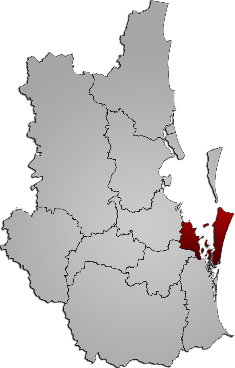
Redland locator: historical 2008 outline MagpieShooter, Wikimedia Commons · 15 March 2008 Original map and boundary source · Open full-size image · Reuse conditions Historic orientation image. Neighbouring council geography predates later de-amalgamations. Not current divisions or an authoritative boundary lookup.
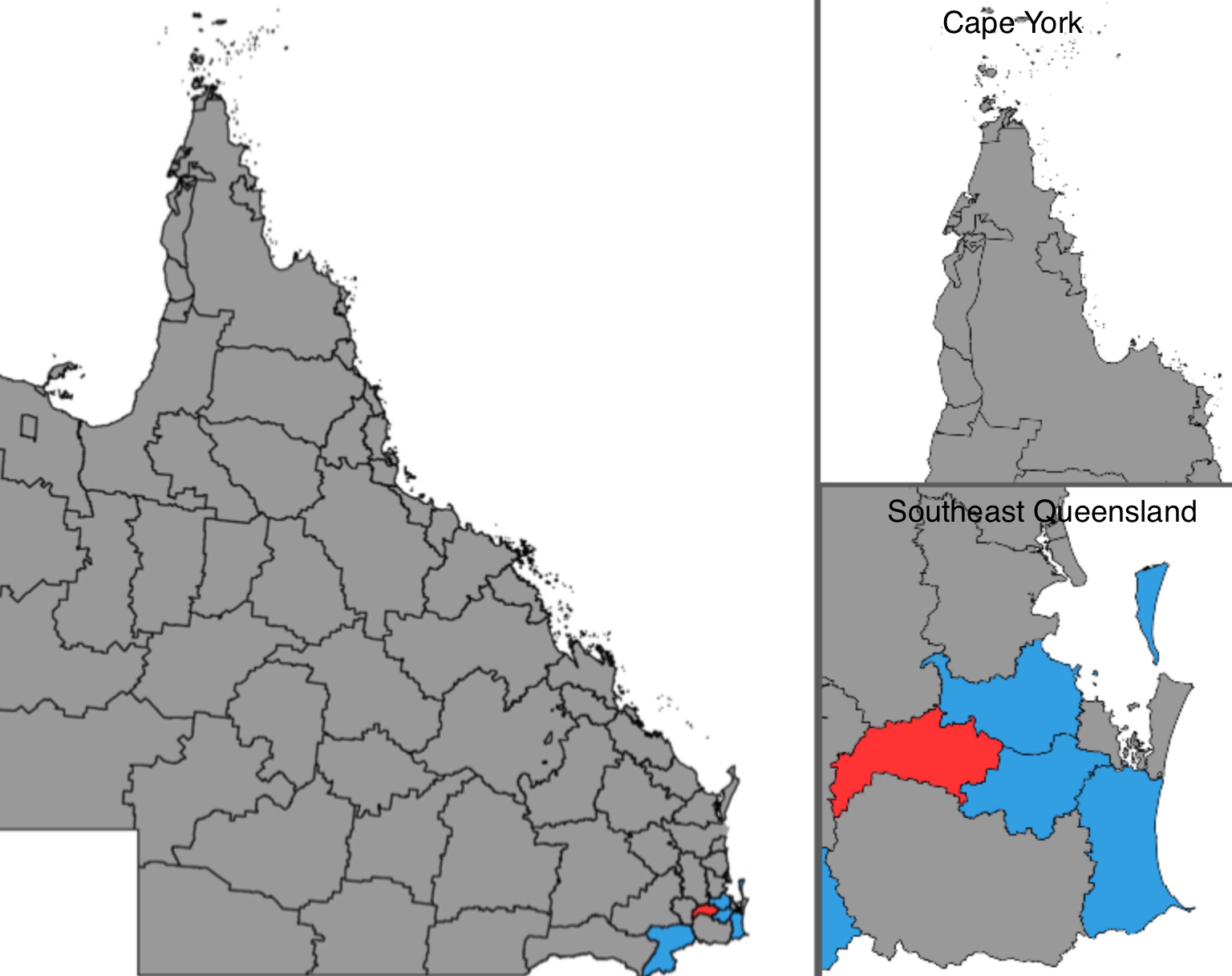
Queensland councils: historical 2020 election map LGA Map, Wikimedia Commons · 2020 election; image created July 2023 Original map and boundary source · Open full-size image · Reuse conditions Historical election map with political colours. These colours must not be presented as current representation or current election results. Use the ECQ finder for current council boundaries.
Bring the source, date, affected figure or statement and your proposed correction. A shared link can point directly to a connection. This first pass accepts no online submissions; prepare a note and use an authorised external route when ready.
Keep the person's question, chosen route and own meaning intact. Distinguish a source, an interpretation and a proposal. Check dates and geography. Carry the three accounts together: cost, freely given contribution and observed change. A page supplies context; action and sharing still follow the person's existing authorisation.